2022

Holmes, C.M. (Applied Analysis Solutions, LLC); Schad, T. (Bayer AG); Preuss, T. (University of Koblenz-Landau, Germany)
Scenario Development for Bee Risk Assessment and Health Modelling Presentation
11.13.2022.
Links | Tags: 2022, Poster, SETAC North America
@misc{NA2022Bee,

title = {Scenario Development for Bee Risk Assessment and Health Modelling},

author = {Holmes, C.M. (Applied Analysis Solutions, LLC) and Schad, T. (Bayer AG) and Preuss, T. (University of Koblenz-Landau, Germany)},

url = {https://appliedanalysis.solutions/wp-content/uploads/2023/08/SETAC-NA-2022-BeeForage.pdf, View Poster},

year  = {2022},

date = {2022-11-13},

urldate = {2022-11-13},

keywords = {2022, Poster, SETAC North America},

pubstate = {published},

tppubtype = {presentation}

}
LaRoe, J. (Applied Analysis Solutions, LLC)
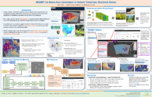
INHABIT for Broad-Scale Assessment of Invasive Terrestrial Vegetation Species Presentation
11.13.2022.
Links | Tags: 2022, Poster, SETAC North America
@misc{NA2022INHABIT,

title = {INHABIT for Broad-Scale Assessment of Invasive Terrestrial Vegetation Species},

author = {LaRoe, J. (Applied Analysis Solutions, LLC)},

url = {https://appliedanalysis.solutions/wp-content/uploads/2023/08/SETAC-NA-2022-INHABIT.pdf, View Poster},

year  = {2022},

date = {2022-11-13},

urldate = {2022-11-13},

keywords = {2022, Poster, SETAC North America},

pubstate = {published},

tppubtype = {presentation}

}
LaRoe, J. (Applied Analysis Solutions, LLC); Holmes, C.M. (Applied Analysis Solutions, LLC); Schad, T. (Bayer AG)
11.13.2022.
Links | Tags: 2022, Poster, SETAC North America
@misc{NA2022Grassland,
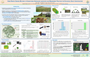
title = {Using Remote Sensing Methods to Characterize Grassland Landscapes and Management Practices for Ecological Health Investigations},
author = {LaRoe, J. (Applied Analysis Solutions, LLC) and Holmes, C.M. (Applied Analysis Solutions, LLC) and Schad, T. (Bayer AG)},
url = {https://appliedanalysis.solutions/wp-content/uploads/2023/08/SETAC-NA-2022-Characterize-Grassland.pdf, View Poster},
year = {2022},
date = {2022-11-13},
urldate = {2022-11-13},
keywords = {2022, Poster, SETAC North America},
pubstate = {published},
tppubtype = {presentation}
}
Holmes, C.M. (Applied Analysis Solutions, LLC); Desmarteau, D. (Waterborne Environmental, Inc.); Ritter, A. (Waterborne Environmental, Inc); Hendley, P. (Phasera Ltd.)
In: Journal of Regulatory Science, vol. 10, no. 1, 2022.
Abstract | Links | Tags: 2022, Peer-Reviewed Publication, Submitted
@article{cropProximity2022,

title = {A national probabilistic characterization of local crop proximity and density for refining US screening level exposure estimates of pesticides in surface water arising from agricultural use},

author = {Holmes, C.M. (Applied Analysis Solutions, LLC) and Desmarteau, D. (Waterborne Environmental, Inc.) and Ritter, A. (Waterborne Environmental, Inc) and Hendley, P. (Phasera Ltd.)},

url = {https://regsci-ojs-tamu.tdl.org/regsci/article/view/216, View Online

http://appliedanalysis.solutions/wp-content/uploads/2023/01/Holmes2023_A_national_probabilistic_characterization_of_local_crop_proximity_and_density_for_refining_US_screening_level_exposure_estimates.pdf, View Document

http://appliedanalysis.solutions/wp-content/uploads/2023/01/Holmes2023_SupplementaryInformation_A_national_probabilistic_characterization_of_local_crop_proximity_and_density.pdf, View Supplementary Information},

doi = {10.21423/jrs-v10a216},

year  = {2022},

date = {2022-10-26},

urldate = {2022-10-26},

journal = {Journal of Regulatory Science},

volume = {10},

number = {1},

abstract = {Rising world population and changing diets are increasing the need for efficient and effective food and fiber production. Pesticides are used across the US to control pests and improve food yield and quality, but these benefits are offset by their potential to reach and possibly impact aquatic or terrestrial ecosystems. Regulatory agencies rely on prospective exposure models that often start with conservative simplifying assumptions that are refined with additional information if needed. The USEPA ecological risk assessment framework for pesticides assumes, at screening level, that 100% of the area draining to a water body is cropped. However, at the grower’s real-world scale, this simplifying assumption is generally not realistic and should be refined for higher tier assessment. The present study developed a US-wide spatially explicit analysis of crop density and proximity to surface waters to characterize the potential for pyrethroid insecticides to enter flowing surface waters. Reliable, transparent, and publicly available government spatial cropping and hydrology datasets were employed at the catchment-scale across the full extent of agricultural production in the US were used to generate fifteen novel crop-specific probabilistic distributions describing the extent and proximity of each crop to the flowing water body defining small catchments. These were used to refine estimated environmental concentrations using USEPA standard regulatory scenarios to evaluate the importance of considering agricultural landscapes when refining aquatic pesticide concentrations. Incorporating these real-world probabilities of crop occurrence and proximity showed that, while potential maximal aquatic exposure concentrations are unchanged, the probability of exceeding regulatory decision-making concentration endpoints is much lower than predicted by standard assumptions (e.g., 1.9 to ~50-fold reductions by crop for 90% of catchments). Additionally, we show that the relative ranking of crops by their aquatic pesticide exposure potential may change from that indicated when cropping density and proximity are considered.},

keywords = {2022, Peer-Reviewed Publication, Submitted},

pubstate = {published},

tppubtype = {article}

}
Holmes, C.M. (Applied Analysis Solutions, LLC); Maltby, L. (The University of Sheffield); Sweeney, P. (Syngenta); Thorbek, P. (BASF); Otte, J.C. (BASF); Marshall, S. (Consultant, UK)
Heterogeneity in biological assemblages and exposure in chemical risk assessment: two landscape-scale case studies Journal Article
In: Ecotoxicology and Environmental Safety, vol. 246, pp. 114143, 2022.
Abstract | Links | Tags: 2022, Peer-Reviewed Publication
@article{Holmes2022,

title = {Heterogeneity in biological assemblages and exposure in chemical risk assessment: two landscape-scale case studies},

author = {Holmes, C.M. (Applied Analysis Solutions, LLC) and Maltby, L. (The University of Sheffield) and Sweeney, P. (Syngenta) and Thorbek, P. (BASF) and Otte, J.C. (BASF) and Marshall, S. (Consultant, UK)},

url = {https://www.sciencedirect.com/science/article/pii/S0147651322009836, View Online

http://appliedanalysis.solutions/wp-content/uploads/2023/01/Holmes_2022_Heterogeneity-in-biological-assemblages-and-exposure-in-chemical-risk-assessment.pdf, View Document

https://appliedanalysis.solutions/wp-content/uploads/2023/01/Holmes_2022_SI_Heterogeneity-in-biological-assemblages-and-exposure-in-chemical-risk-assessment.pdf, View Supplemental Information},

doi = {10.1016/j.ecoenv.2022.114143},

year  = {2022},

date = {2022-10-03},

urldate = {2022-10-03},

journal = {Ecotoxicology and Environmental Safety},

volume = {246},

pages = {114143},

abstract = {Current prospective chemical risk assessment frameworks do not directly address the landscape-scale heterogeneity of exposure and ecological receptors because they assume that reasonably worst-case chemical exposure concentrations co-occur, spatially and temporally, with species assemblages that are most sensitive to the chemical’s toxicity. Whilst current approaches aim to be protective, a more precise understanding of when and where exposure and species co-occur enables risk assessments to be better tailored and mitigation made more efficient.  We use two aquatic case studies covering different spatial and temporal resolution to explore how geo-referenced data and spatial tools might be used to account for landscape heterogeneity of exposure and receptors in prospective risk assessment. We investigate how distributions of spatially referenced chemical exposure and ecological assemblages can be integrated to assess and interpret risk with each case study following a stepwise approach: i) estimate and establish spatial exposure distributions; ii) derive toxicity thresholds for various taxonomic groups and determine geo-referenced distributions of exposure-toxicity ratios, i.e. potential risk; iii) overlay risk data with the ecological status of the European Union’s Water Framework Directive biomonitoring sites to determine if relationships exist. We focus on demonstrating whether integration of relevant data and potential approaches was feasible rather than making comprehensive and refined assessments of specific chemicals.  The studies indicate that geo-referenced predicted environmental concentration estimations  can be achieved with available data, models and tools but establishing the distribution of species assemblages is limited by availability of biomonitoring data and fewer tools. The studies highlight the important influence that choices for aggregating data and for the selection of statistical metrics have on assessing and interpreting risk at different spatial scales and patterns of distribution within the landscape. Finally, we discuss approaches that could help to address environmental heterogeneity in chemical risk assessment.},

keywords = {2022, Peer-Reviewed Publication},

pubstate = {published},

tppubtype = {article}

}
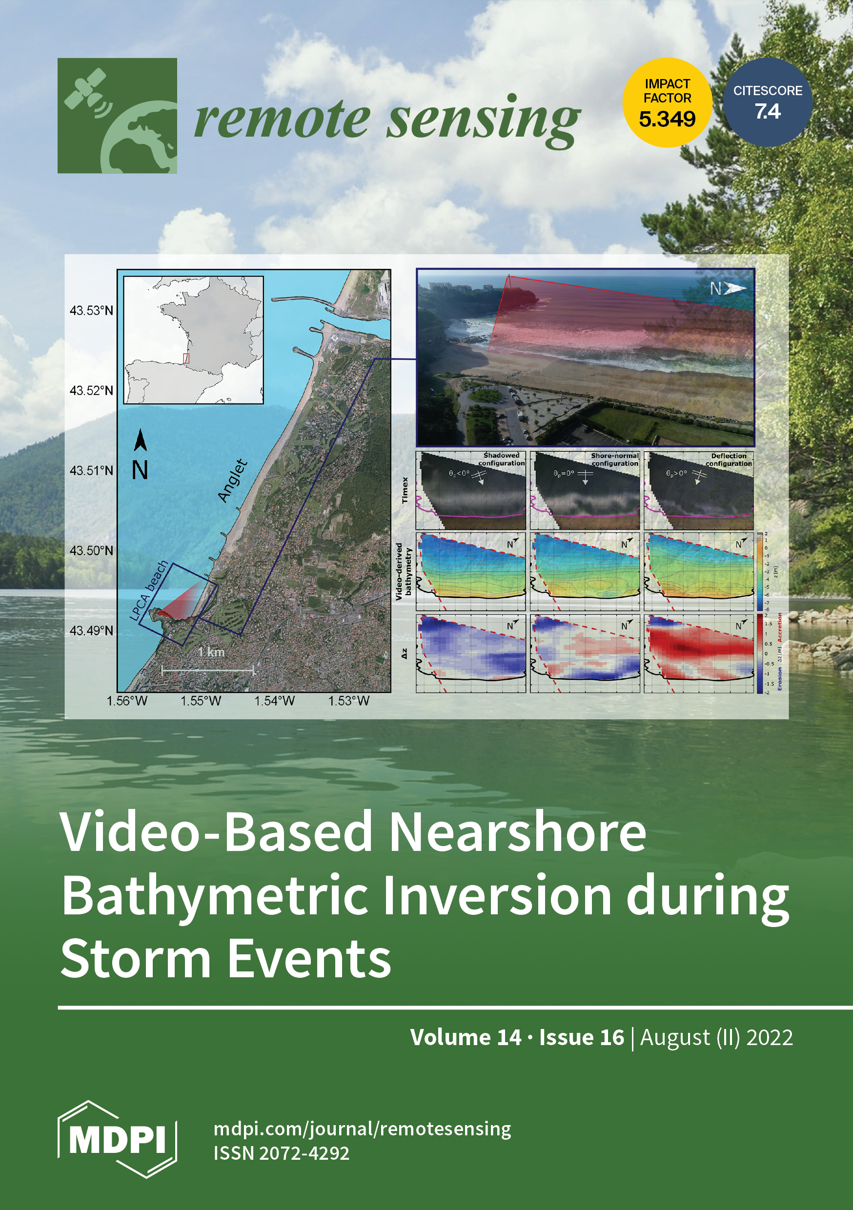
LaRoe, J. (Applied Analysis Solutions, LLC); Holmes, C.M. (Applied Analysis Solutions, LLC); Schad, T. (Bayer AG)
Nightlight Intensity Change Surrounding Nature Reserves: A Case Study in Orbroicher Bruch Nature Reserve, Germany Journal Article
In: Remote Sensing, vol. 14, iss. 16, no. 3876, pp. 1-19, 2022.
Abstract | Links | Tags: 2022, Peer-Reviewed Publication, Remote Sensing
@article{nokeyb,

title = {Nightlight Intensity Change Surrounding Nature Reserves: A Case Study in Orbroicher Bruch Nature Reserve, Germany },

author = {LaRoe, J. (Applied Analysis Solutions, LLC) and Holmes, C.M. (Applied Analysis Solutions, LLC) and Schad, T. (Bayer AG)},

url = {https://www.mdpi.com/2072-4292/14/16/3876, View Online

https://appliedanalysis.solutions/wp-content/uploads/2023/01/LaRoe-2022-Nightlight-Intensity-Change-Surrounding-Nature-Reserves-A-Case-Study-in-Orbroicher-Bruch-Nature-Reserve-Germany.pdf, View Document},

doi = {10.3390/rs14163876},

year  = {2022},

date = {2022-08-10},

urldate = {2022-08-10},

journal = {Remote Sensing},

volume = {14},

number = {3876},

issue = {16},

pages = {1-19},

abstract = {This article belongs to the Special Issue Remote Sensing of Night-Time Light.


Persistent global urbanization has a direct relationship to measurable artificial light at night (ALAN), and the Defense Meteorological Satellite Program has served an important role in monitoring this relationship over time. Recent studies have observed significant declines in insect abundance and populations, and ALAN has been recognized as a contributing factor. We inves-tigated changes in nightlight intensity at various spatial scales surrounding insect traps located in Orbroicher Bruch Nature Reserve, Germany. Using a time series of global nighttime light imagery (1992–2010), we evaluated pixel-level trends through linear regressions and the Mann–Kendall test. Paired with urban land cover delineation, we compared nightlight trends across rural and urban areas. We utilized high-resolution satellite imagery to identify landscape features poten-tially related to pixel-level trends within areas containing notable change. Approximately 96% of the pixel-level trends had a positive slope, and 22% of pixels experienced statistically significant increases in nightlight intensity. We observed that 80% of the region experienced nightlight in-tensity increases >1%, concurrent with the observed decline in insect biomass. While it is unclear if these trends extend to other geographic regions, our results highlight the need for future studies to concurrently investigate long-term trends in ALAN and insect population decline across multiple scales, and consider the spatial and temporal overlaps between these patterns.},

keywords = {2022, Peer-Reviewed Publication, Remote Sensing},

pubstate = {published},

tppubtype = {article}

}
Persistent global urbanization has a direct relationship to measurable artificial light at night (ALAN), and the Defense Meteorological Satellite Program has served an important role in monitoring this relationship over time. Recent studies have observed significant declines in insect abundance and populations, and ALAN has been recognized as a contributing factor. We inves-tigated changes in nightlight intensity at various spatial scales surrounding insect traps located in Orbroicher Bruch Nature Reserve, Germany. Using a time series of global nighttime light imagery (1992–2010), we evaluated pixel-level trends through linear regressions and the Mann–Kendall test. Paired with urban land cover delineation, we compared nightlight trends across rural and urban areas. We utilized high-resolution satellite imagery to identify landscape features poten-tially related to pixel-level trends within areas containing notable change. Approximately 96% of the pixel-level trends had a positive slope, and 22% of pixels experienced statistically significant increases in nightlight intensity. We observed that 80% of the region experienced nightlight in-tensity increases >1%, concurrent with the observed decline in insect biomass. While it is unclear if these trends extend to other geographic regions, our results highlight the need for future studies to concurrently investigate long-term trends in ALAN and insect population decline across multiple scales, and consider the spatial and temporal overlaps between these patterns.
Ritter, A. (Waterborne Environmental, Inc); Desmarteau, D. (Waterborne Environmental, Inc.); Hendley, P. (Phasera Ltd.); Holmes, C.M. (Applied Analysis Solutions, LLC)
National characterization of pesticide runoff and erosion potential to put USEPA standard ecological scenarios in context for pyrethroids Journal Article
In: Integrated Environmental Assessment and Management, vol. 00, no. 00, pp. 1-16, 2022.
Abstract | Links | Tags: 2022, Peer-Reviewed Publication
@article{nokey,

title = {National characterization of pesticide runoff and erosion potential to put USEPA standard ecological scenarios in context for pyrethroids},

author = {Ritter, A. (Waterborne Environmental, Inc) and Desmarteau, D. (Waterborne Environmental, Inc.) and Hendley, P. (Phasera Ltd.) and Holmes, C.M. (Applied Analysis Solutions, LLC)},

url = {https://setac.onlinelibrary.wiley.com/doi/10.1002/ieam.4647,  Online Publication

https://appliedanalysis.solutions/wp-content/uploads/2022/07/Integr-Envir-Assess-Manag-2022-Ritter-National-characterization-of-pesticide-runoff-and-erosion-potential-to-put.pdf, View document},

doi = {10.1002/ieam.4647},

year  = {2022},

date = {2022-06-09},

urldate = {2022-06-09},

journal = {Integrated Environmental Assessment and Management},

volume = {00},

number = {00},

pages = {1-16},

abstract = {Decision-making for pesticide registration by the US Environmental Protection Agency (USEPA) relies upon crop-specific scenarios in a tiered framework. These standard modeling scenarios are stated to represent “…sites expected to produce runoff greater than would be expected at 90% of the sites for a given crop/use.” This study developed a novel approach to compare the pesticide runoff + erosion (SumRE) mass flux potential of a hydrophobic chemical using 36 of these ecological regulatory scenarios with national-scale distributions of modeled SumRE from over 750 000 USA-wide agricultural catchments to provide real-world context for the simulated transport predictions used for regulatory decision-making. For the standard scenarios and national scale modeling, “edge of field” SumRE mass flux was estimated using regulatory guidance for a hypothetical pyrethroid. The national-scale simulations were developed using publicly available soil, hydrography, and crop occurrence /regional timings databases. Relevant soil and crop combinations identified by spatial overlay along with weather data were used in a regulatory model to generate daily SumRE estimates, which were assigned to the catchments. The resulting average annual total SumRE mass fluxes were ranked to produce distributions to compare with the standard regulatory scenario outputs. These comparisons showed that SumRE flux from 25 of the 36 USEPA ecological regulatory crop-specific scenarios modeled ranked above the 99th percentile of pyrethroid runoff + erosion vulnerability from any catchment growing that crop; SumRE flux from six scenarios was more severe than any catchment. For 12 USEPA regulatory scenarios, the resulting eroded sediment corresponds to highly erodible land (HEL), which the US Department of Agriculture mandates should not be cropped without substantial additional erosion prevention controls for sustainability. Since the pesticide regulatory framework already incorporates many acknowledged assumptions to ensure it conservatively meets protection goals, these HEL observations suggest that the standard scenarios overestimate potential aquatic exposure and that the regulatory process is more protective than intended. Integr Environ Assess Manag 2022;00:1–16. © 2022 The Authors. Integrated Environmental Assessment and Management published by Wiley Periodicals LLC on behalf of Society of Environmental Toxicology & Chemistry (SETAC).},

keywords = {2022, Peer-Reviewed Publication},

pubstate = {published},

tppubtype = {article}

}
Miglino, A.N. (U.S. Food & Drug Administration); Holmes, C.M. (Applied Analysis Solutions, LLC)
Applying weight of evidence methods to assessing exposure in aquatic environments: Comparing lines of evidence Journal Article
In: Integrated Environmental Assessment and Management, 2022.
Abstract | Links | Tags: 2022, Peer-Reviewed Publication
@article{WeightOfEvidence2022,

title = {Applying weight of evidence methods to assessing exposure in aquatic environments: Comparing lines of evidence},

author = {Miglino, A.N. (U.S. Food & Drug Administration) and Holmes, C.M. (Applied Analysis Solutions, LLC)},

url = {https://setac.onlinelibrary.wiley.com/doi/10.1002/ieam.4602, View online},

doi = { https://doi.org/10.1002/ieam.4602},

year  = {2022},

date = {2022-03-07},

urldate = {2022-03-07},

journal = {Integrated Environmental Assessment and Management},

abstract = {This article is part of the special series “Practical Considerations for Application of Weight of Evidence (WoE) in Chemical Evaluations” and was generated in part from several SETAC-sponsored workshops and symposia organized between 2015 and 2019. These included symposia in each of the SETAC Geographic Units as well as a Pellston Workshop on data usability. This series aims to reflect the broad applicability of WoE methodology in environmental risk assessment for chemical evaluations when combined with a classic tiered assessment approach, applicable regardless of regulatory structures. The articles discuss transparent mechanisms for communicating decision-making processes and critically examine case studies that lay out a guide for implementing WoE for improving chemical evaluations to increase their acceptability by regulators, risk managers, NGOs, and other stakeholders for desired protection goals.


Weight of evidence (WoE) is a useful approach to quantifying the relative relevance, strength, reliability, and uncertainty associated with estimates of exposure concentrations. WoE is often used in exposure assessments but rarely explored or discussed in detail. In this article, the utility of a WoE approach in aquatic exposure assessments is illustrated via two case studies using a tiered approach and the chemical triclosan. Each case study evaluates the same chemical and pathway to the environment but with substantially different data strength, reliability, and uncertainty. The collection and qualitative evaluation of relevant lines of evidence (LoE) using a three-tiered approach are discussed. Our results demonstrate how a higher tiered WoE approach can reduce uncertainty and improve decision-making based on predicted exposure concentrations. We also identify LoE that played a significant role in the final exposure determinations and describe a framework for conducting exposure assessments using WoE. Integr Environ Assess Manag 2022;00:1–13. © 2022 SETAC},

keywords = {2022, Peer-Reviewed Publication},

pubstate = {published},

tppubtype = {article}

}
Weight of evidence (WoE) is a useful approach to quantifying the relative relevance, strength, reliability, and uncertainty associated with estimates of exposure concentrations. WoE is often used in exposure assessments but rarely explored or discussed in detail. In this article, the utility of a WoE approach in aquatic exposure assessments is illustrated via two case studies using a tiered approach and the chemical triclosan. Each case study evaluates the same chemical and pathway to the environment but with substantially different data strength, reliability, and uncertainty. The collection and qualitative evaluation of relevant lines of evidence (LoE) using a three-tiered approach are discussed. Our results demonstrate how a higher tiered WoE approach can reduce uncertainty and improve decision-making based on predicted exposure concentrations. We also identify LoE that played a significant role in the final exposure determinations and describe a framework for conducting exposure assessments using WoE. Integr Environ Assess Manag 2022;00:1–13. © 2022 SETAC